Ski touring in the terrain
Ski Touring at dachstein glacier
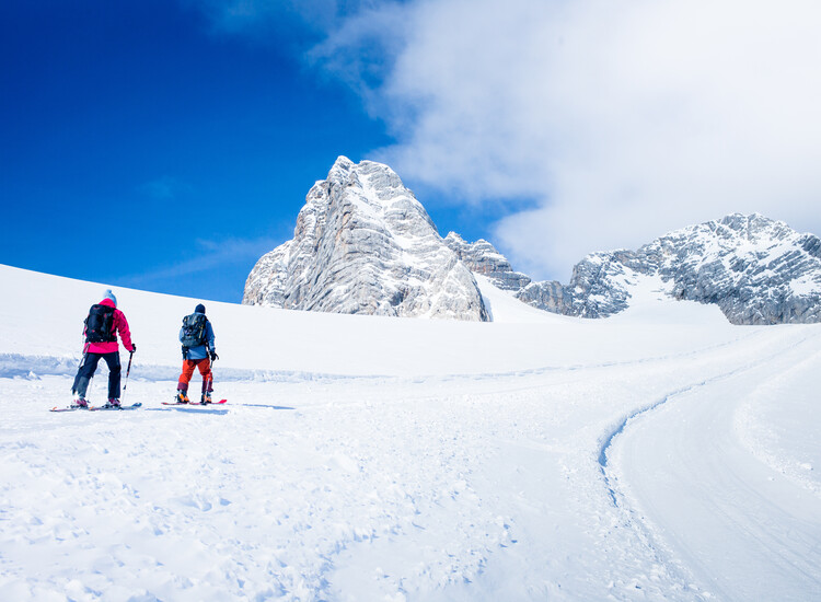
Ski touring is a fascinating way to experience the winter mountain landscape up close. The Dachstein Glacier offers true
A NATURAL EXPERIENCE AND A SPORTING CHALLENGE
Ski touring combines physical challenge with the experience of nature. Using climbing skins under the skis, you conquer the vertical meters through your own strength, and after the ascent, breathtaking views of the mountain world await. Whether you prefer leisurely beginner tours on groomed slopes or challenging routes in open terrain, the Dachstein Glacier has the right challenge for every level. Proper preparation and the necessary equipment are essential to ensure you can enjoy your tour safely and to the fullest.
Skitouring Ticket
VALID TO 09.11.2025 INCLUDING the toll for Dachstein Mautstrasse
| Adult | Youth | Child | |
|---|---|---|---|
|
Day ticket |
€ 59,00 | € 44,50 | € 29,50 |
If you are in possession of a Ski Amadé ALL-IN Card gold or white, SuperSkiCard, Ski amadé day or multi-day ticket or the Steiermark Joker, the ascent on the Dachstein Glacier cable car is included.
IMPORTANT NOTE TOLL:
Please have your toll ticket validated at the machine in the Dachstein mountain station so that you can enjoy free use of the road.
14 Eissee
When deep snow beckons! A diverse ski tour across the Hallstatt glacier to the Oberer Eissee lake. This tours leads via the Simonyhütte lodge and the groomed trail back to the mountain station on the Hunerkogel.
THE ROUTE AT A GLANCE
|
Start |
Dachstein mountain station (2,687m) |
|---|---|
| Finish | Dachstein mountain station (2,687m) |
| Difficulty | red |
| Metres in altitude | 660m/660m (ascent/descent) |
| Time required |
approx. 4,5 hours |
Route description
Starting at the Dachstein mountain station, this tours leads briefly downhill to beneath the Dirndl peak where you turn right from the groomed trail. Take care! You are in the open ski area and in early winter there can be crevasses in the relatively flat, upper part of the Hallstatt glacier. Swing right from the Eisstein down the inviting, increasingly steep slopes and then cross left beneath the Eisstein and follow the wide glacier tongue to the Upper Eissee lake. Please ensure that you heed the avalanche forecast.
From the Eissee lake you ascend briefly to the Simonyhütte lodge (food and drink available) and past the groomed trail behind the Schöberl peak in a long loop along the west side of the Hallstatt glacier to the Steinerscharte gap, Seethalerhütte lodge and Gjaidsteinscharte gap back to the starting point. The ascent is technically easy but please take note of the total length and elevation of this tour.
Since this tour runs through the open ski area, please take the necessary ski equipment (avalanche transceiver/shovel/probe) and inform yourself about weather conditions in advance.
Variant
The ascent can be shortened by climbing from the Eissee lake directly via the eastern end of the Hallstatt glacier beneath the Hoher Gjaidstein and Kleiner Gjaidstein peaks towards the Gjaidstein saddle rather than via the Simonyhütte lodge.
All variants are unmarked and lead through the open and largely glaciated ski area. They require proper tour planning, avalanche knowledge and very good local knowledge. We strongly advise that the services of a mountain and ski guide with local knowledge are employed.
Note
Please note that the demands on your physical fitness increase considerably with possible variants.
15 Rumpler Runde
A popular ski tour on the Dachstein massif. The route is technically relatively easy, but is one of the longer tours and requires a certain sense of orientation. The descent leads over the Hallstatt glacier, past the Simonyhütte lodge to the Gjaidalm lodge. From here, the ascent starts around the Gjaidsteinstock mountain back to the Schladming glacier. A lovely day tour.
THE ROUTE AT A GLANCE
|
Start |
Dachstein mountain station (2,687m) |
|---|---|
| Finish | Obertraun cable car (600 m) |
| Difficulty | red |
| Metres in altitude | 1,200 m (ascent/descent) |
| Time required |
approx. 7 hours |
Route description
Up to the Gjaidalm lodge, the route follows the classic Dachstein crossing. From the Dachstein mountain station, you descend briefly to below the Dirndl peak on the groomed and marked trail, then ascend briefly towards the Seethaler Hütte lodge. At the signposted turn-off towards the Simonyhütte lodge, the easy descent begins via the groomed and marked trail along the western edge of the Hallstatt glacier to the Simonyhütte lodge (food and drink available). From here, continue along the signposted and groomed trail with short counter ascents to the Gjaidalm lodge (food and drink available).
The ascent begins here. You now pass the valley station of the Krippenstein gondola (section 3) on the Oberfeld and follow the post markings in a south-easterly direction. On the right are the Niederer Rumpler and Hoher Rumpler and the Moderstein peaks. The route turns south through hilly terrain towards the Schladming glacier past the Niederer Gjaidstein to the former valley station of the Mitterstein chairlift (decommissioned). From here, remain on the groomed trail across the glacier back to the starting point at the mountain station.
Variants
There are two interesting variants to this route. On the one hand, you can turn off via the Feisterscharte gap towards the Guttenberghaus lodge (closed in winter), or ascend via the Landfriedtal valley to the Gruberscharte cirque. Both variants descend via south-facing slopes to Ramsau (Gasthof Feisterer, food and drink available).
All of these variants are only partially marked and lead through the open ski area. Please ensure that you have the correct safety equipment. They require a high level of skiing ability, proper tour planning, avalanche knowledge and very good local knowledge.
We strongly advise that the services of a mountain and ski guide with local knowledge are employed.
Equipment
Standard safety equipment (avalanche transceiver, shovel, probe, first aid), telephone, GPS app. Network coverage is sufficient.
16 Guttenberghaus
This fantastic ski tour takes you via the Schladming glacier and Feisterscharte gap past the Guttenberghaus lodge to Ramsau. This route requires little ascent and plenty of descent and offers an abundance of panoramic views.
The landscape on the descent is spectacular and although there is only a small elevation gain, this tour requires skiing ability and endurance. Experience of assessing avalanche risk is required. The route is only partly marked with posts.
THE ROUTE AT A GLANCE
|
Start |
Dachstein mountain station (2,687m) |
|---|---|
| Finish | Gasthof Feisterer (1,150 m) |
| Difficulty | red |
| Metres in altitude | 200m/1,500m (ascent/descent) |
| Time required |
approx. 3.5 hours |
Route description
You descend from the mountain station via the Schladming glacier beneath the decommissioned Mitterstein chairlift (lovely north-facing slopes) to the old valley station. Next you strap on your skins and follow the signposts eastwards towards the Feisterscharte gap. The markedly hilly terrain is typical for the Dachstein massif and constantly undulates. At the Feisterscharte gap remove your skins and once past the Guttenberghaus lodge bear left into the Tiefkar peak. At the end beneath the Fischermauer rockface cross into the Feistergraben rift and follow the increasingly wooded slopes as far as the Feisterer lift (also called the Schneemandl lift). From the Feistererhof hotel (where food and drink are available) ski right across the undulating meadows to the state road to the bus station. The bus takes you back to Ramsau and to the valley station of the glacier cable car.
The route runs almost exclusively through the free ski area. Alpine knowledge is important in this terrain and orientation is extremely difficult in fog. Expert avalanche assessment is necessary for the descent. Please ensure that you take note of the avalanche forecast and weather report.
EQUIPMENT
Standard safety equipment (avalanche transceiver, shovel, probe, first aid), telephone, GPS app. Network coverage is sufficient.
17 Gruberscharte
With a little luck you will find both deep-snow descents and firn slopes on this captivating tour! The route leads over the Schladming glacier, descending on increasingly steep slopes to the foothills of the Koppenkarstein mountain. From here you ascend sweeping terrain to the Gruberscharte col. This is the starting point for the long descent from the striking col to the Gasthof Feisterer hotel in Ramsau/Dachstein.
This ski tour requires a sense of orientation, the ability to assess avalanche risk, skiing ability and fitness for the long descent.
|
Start |
Dachstein mountain station (2,687m) |
|---|---|
| Finish | Gasthof Feisterer (1,150 m) |
| Difficulty | red |
| Metres in altitude | 350 m/1,650 m (ascent/descent) |
| Time required | approx. 3.5 hours |
Route description
You descend from the mountain station via the south-eastern part of the Schladming glacier along the mighty northern faces of the Koppenkarstein on wide, increasingly steep slopes. Attention should be paid to avalanche risk in the lower section in particular. Keeping to the right ascend briefly in a slight arc (your skis can be carried on your shoulders here), then descend briefly into the hollow between the Koppenkarstein and Landfriedstein mountains. Here put on your skins and bypass the Landfriedstein on a gentle ascent, crossing into the open Landfriedtal valley and ascending towards the Gruberscharte col (the last 60 metres of elevation gain are often clear of snow so you can strap your skis to your rucksack here).
Access to the massive Gruberkar cirque from the Gruberscharte col. Depending on conditions and the avalanche situation, bearing right as you descend there is a series of sensational slopes until the forest cover slightly increases and the terrain ends at the Feisterer lift (also called the Schneemandl lift).
From the Feistererhof hotel (where food and drink are available) ski right across the undulating meadows to the state road to the bus station. The bus takes you back to Ramsau and to the valley station of the glacier cable car.
The route runs exclusively through the open ski area. Alpine knowledge is important in this terrain and orientation is extremely difficult in fog. Expert avalanche assessment is necessary for the descent. Please ensure that you take note of the avalanche forecast and weather report.
EQUIPMENT
Standard safety equipment (avalanche transceiver, shovel, probe, first aid), telephone, GPS app. Network coverage is sufficient.
18 Notgasse
Anyone wishing to experience the wild expanse of the Dachstein massif in winter should consider this tour. This more than 25-kilometre crossing leads from the Schladming glacier via the Auf dem Stein high plateau through the historically significant Notgasse to the furnaces near Gröbming. This route requires good tour planning and a sense of orientation. It is a spectacular tour that is not technically challenging.
Incidentally, the name does not derive from being in a difficult situation (‘Not’ means distress in German) but from ‘Hnod’ – the Celtic word for ‘holy fire’.
|
Start |
Dachstein mountain station (2,687m) |
|---|---|
| Finish | Gröbming Lend (900 m) |
| Difficulty | red |
| Metres in altitude | 150 m/2,000 m(ascent/descent) |
| Time required | approx. 6 hours |
Route description
You descend from the mountain station via the Schladming glacier beneath the decommissioned Mitterstein chairlift (lovely north-facing slopes) to the old valley station. From here traverse the hilly terrain eastwards (the Stoderzinken mountain is the main point of reference for orientation as the route is only partially marked with posts) – depending on conditions this tour is also possible without skins. En route you pass the derelict Lackenmoosalm lodge and the unserviced Schildenmoosalm lodge. Here you cross the impressive Notgasse gorge with its historic rock paintings. If it is not possible to walk along the Notgasse due to a lack of snow or the conditions, it is also an option to bypass the gorge via a forest path.
Under the Notgasse you follow a simple forest road to the rock remnants of the furnaces near Gröbming. Here the best option is to be picked up by a taxi if you have not parked a second vehicle beforehand.
If there is fresh snow or visibility is poor, orientation is very difficult. If in doubt, it is advisable to use the services of an experienced local mountain and ski guide.
Variants
It is possible to tackle the Lackner Miesberg (2,232 metres) as a summit. This naturally requires skins, so the necessary additional time should also be taken into account.
19 Dachstein
The Dachstein is one of the most famous mountains in the eastern Alps. Its summit lies on the border between Styria and Upper Austria, and at over 3,000 metres it reigns over the Dachstein massif and the Ennstal valley. The panorama is stunning – to the north extend the Salzkammergut and Ausseerland regions, while to the east lie the Totes Gebirge and Gesäuse mountain ranges. In the south-east are the Niedere Tauern mountains, whilst to the south-west you have a sweeping view of the Hohe Tauern, a range which boasts Austria’s highest peaks.
A winter ascent offers an additional attraction. The often snow-covered climb is more challenging than in summer, though you will hopefully be rewarded with a view of a snow-encrusted summit cross.
This tour is for advanced skiers, and it is recommended that you employ the services of a mountain and ski guide.
|
Start |
Dachstein mountain station (2,687m) |
|---|---|
| Finish | Dachstein mountain station (2,687m) |
| Difficulty | black |
| Metres in altitude | 460 m/460 m (ascent/descent) |
| Time required |
approx. 3:30 hours |
Route description
Descent from the Dachstein mountain station to beneath the Dirndl along the groomed and marked path. Here you don your skins and follow the trail in a long left-hand bend to the shoulder ascent. From here, and depending on the avalanche situation, ascend via the steep, glaciated summit slope towards the randkluft. The eponymous randkluft no longer poses much difficulty as the glacier is now riven around 50 metres below the entrance by a massive crevasse. This crevasse can be an obstacle in early winter or if there is not much snow and is normally crossed ascending to the right – if in doubt please use a safety rope. The last few metres to the start of the via ferrata are steep, so it is advisable to set up a ski depot at a suitable point in good time and put on crampons, climbing harness and via ferrata set.
The 100 metre-long, partially-exposed ascent from the randkluft to the summit is almost continuously secured with a steel cable, which is often snow-covered in winter. However, after snowfall you have to make tracks, especially in the upper section.
A similar amount of time for the descent to the ski depot should be allowed as for the ascent. Here a great northern slope with often sensational snow awaits you – please ensure that you take note of the avalanche situation. Food and drink is available at the Seethalerhütte lodge. Finally, the easy descent and the short ascent to the mountain station of the glacier cable car follow the familiar route.
Variant
The summit can also be reached via the shoulder ascent (250 metres). This is recommended if the risk of avalanches below the Randkluftsteig is too great. This ascent is also secured with a steel cable, with the last section leading over the upper part of the Randkluftsteig. Crampons and a via ferrata set are also required here.
NOTE
This ski tour requires surefootedness, the use of a via ferrata set and crampons as well as a general ability to assess avalanche risk. It is generally recommended that you are accompanied by a mountain and ski guide on this tour.
Equipment
Standard safety equipment (avalanche transceiver, shovel, probe, first aid), telephone, GPS app. Network coverage is sufficient. Crampons (suitable for ski touring boots), harness and via ferrata set, pick. Perhaps a short rope.
Safety First
A modern avalanche transceiver, metal avalanche shovel, and a probe are among the basic items of equipment on any ski tour which takes place away from secured pistes and in the open ski area. This is because this triumvirate of transceiver/shovel and probe is important not only for being found quickly but above all to swiftly assist possible companions or other buried people.
A smartphone is also essential. It is recommended that you install a GPS app and familiarise yourself with its use. Network coverage is generally good on the Dachstein. A small first aid package with a multi-tool should also always be carried.
On some tours, it is recommended that a glacier harness and via ferrata set, crampons, pick, and a short rope are carried in order to be able to effectively react to the snow situation and conditions. You will find the exact equipment for the respective tours in the individual route descriptions.
The alpine emergency number is 140 in Austria (112 in Europe).
If you have no network reception, please restart your phone. Dial the emergency service before you enter the PIN code for your SIM card, as you can also make an emergency call on a third-party network.
Find out about the current avalanche situation before every tour at www.lawine-steiermark.at >>


